Watersheds > Lake Champlain Drainage Basin

-
Basin 6 — Missisquoi
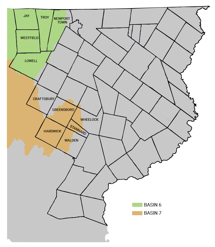
Basin 6 includes the towns of Jay, Westfield, Lowell, Troy, and Newport Town in the western portion of Orleans County. The main bodies of water throughout the basin are the Missisquoi River, Pike River, and Rock River. The primary stressors in this area are channel and land erosion as well as nutrient loading. Much of the local erosion was caused by fine soil creating instability along the channels, which then deposited large amounts of sediment into the waters. The high amounts of phosphorus is due to the agricultural runoff into the various bodies of water, with the priority areas being Rock River, Lake Carmi, Black Creek, Mud Creek, and tributaries along the Mid Missisquoi.
Projects targeted at the area:
— Reduction of phosphorus throughout the basin using RAPs, leading to a reduction of phosphorus levels in Lake Champlain
— Implementation of agricultural BMPs along Mud Creek to reduce runoff
— Repairing river corridors along Black River to reduce erosion and sediment deposits
Additional Information:
-
Basin 7 — Lamoille
Basin 7 contains a small portion of Orleans and Caledonia, including Hardwick and portions of Craftsbury, Greensboro, Wheelock, Stannard, and Walden. The basin includes the Lamoille River as well as its tributaries, though the main portion in the Northeast Kingdom is the Upper Lamoille. The main stressors in the Upper Lamoille include flow alteration, and land and channel erosion. Hardwick Land and Caspian Lake have been affected by water level fluctuation. Haynesville Brook, Tucker Brook, and Stannard Brook have erosion issues due to flooding and post-flood work.
Projects targeted at the area:
— Repairing and protection of river corridors along Haynesville Brook, Tucker Brook, Stannard Brook, and Wild Branch
— Completion of stormwater master plans in Hardwick, Greensboro, and Stannard
— Evaluate removal of Jackson Dam to alleviate flow alteration at Hardwick Lake
Additional Information:

